This year, ArcMap has retired. It’s time to transform to a new mapping software. Many universities start using ArcGIS Pro, a paid software made from the same company as ArcMap.
Oh, you don’t have a liscense? Or you use MacOS or Linux. Here’s another option: you can use QGIS, which is free. Mapping softwares are similar.
I will NOT provide steps in detail because that's gonna be quite long. But I recommend you type in those questions on google, YouTube or ChatGPT, which will give you solid answers.
Rough Ideas #
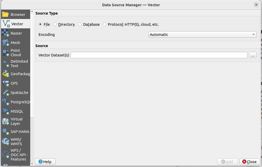
1. How to Add a Vector Layer? #
- Navigate to Layer > Data Source Manager > Vector. To add your file, click the three dots (…) to find your shapefile and add it.
2. Select by Attribute? #
- In QGIS, it’s called “Select Features by Value” or “Select Features by Expression”. Watch this video:
3. Select by Location? #
- Use the following icon:

4. Change the Coordinate System? #
- Right-click on your layer and select Layer CRS.
5. Where’s Print Layout? Legend? Arrow? Etc.? #
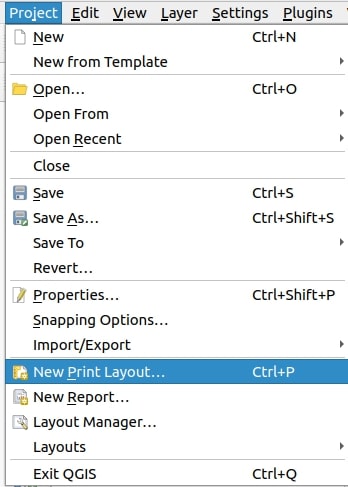
- To view the print layout you’ve created, go to Layout Manager.
- For more details, this article will help: QGIS Print Layout and Exporting .
6. How to Insert a Secondary Map in Layout View? How to Add a New Dataframe? #
- Currently, I’m not sure how to add a new dataframe. One workaround is to create another map file, export the second map as an image, and insert that image into the first map.
7. How to Add XY Data? #
- Ensure your data is in CSV format. If you need to import XLS directly, you can add a plugin (search for the appropriate plugin on Google).
- Check out this video for more information:
Last modified on 2024-06-22